The use of drones in real estate photography has revolutionized the way properties are showcased to potential buyers. Aerial imagery provides a unique perspective that traditional ground-based photography cannot achieve, offering a comprehensive view of the property and its surroundings. This technology has become an essential tool for real estate agents, developers, and marketers seeking to enhance their listings and attract more interest.
Advantages of Drone Photography in Real Estate
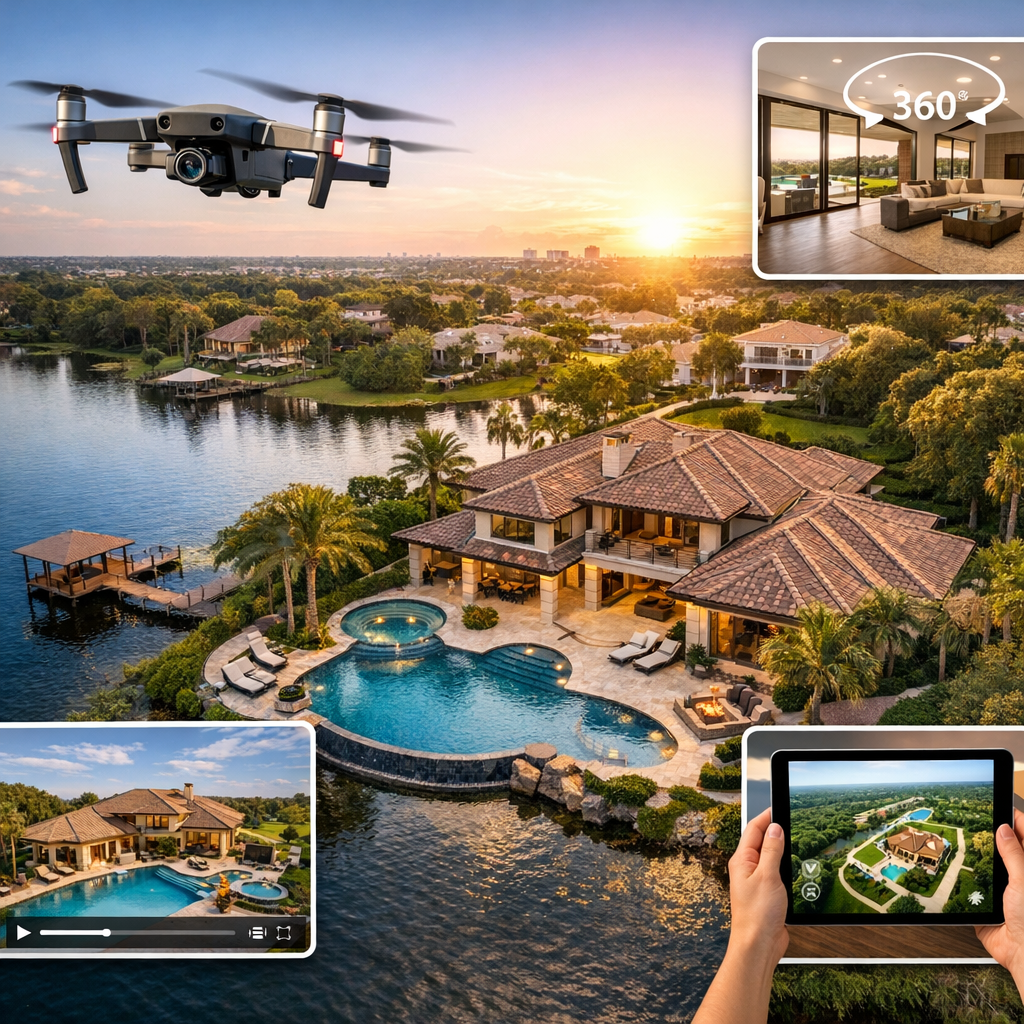
Drones allow photographers to capture high-resolution images and videos from various angles and elevations. This capability highlights property features such as landscaping, architecture, and proximity to amenities. Aerial shots can also demonstrate the scale of large estates, commercial properties, or land developments, giving potential buyers a better understanding of the layout and environment.


Additionally, drone photography can create dynamic marketing materials. Video tours, panoramic views, and interactive maps provide immersive experiences that engage viewers and increase the likelihood of inquiries. These visual assets can be shared across multiple platforms, including websites, social media, and virtual tours, amplifying the property’s visibility.
Technical Considerations
To achieve professional-quality results, it is important to use drones equipped with high-resolution cameras, gimbal stabilization, and advanced flight controls. Proper lighting conditions, typically during early morning or late afternoon, can enhance image quality and reduce harsh shadows. Pilots should plan flight paths carefully to capture key features while maintaining smooth and stable footage.


Post-processing also plays a crucial role in refining aerial images. Adjusting contrast, brightness, and color balance ensures that the final visuals are both accurate and appealing. Combining aerial shots with ground-level photography can create a complete visual narrative of the property.
Legal and Safety Regulations
Operating drones for commercial purposes requires adherence to local aviation regulations. In many regions, drone pilots must obtain certification and follow specific guidelines regarding altitude limits, no-fly zones, and privacy considerations. Ensuring compliance not only avoids legal issues but also promotes safe and responsible drone usage.


Property owners should be informed before conducting aerial shoots, especially in residential areas. Respecting privacy and obtaining necessary permissions helps maintain trust and professionalism.
Future Trends in Aerial Property Photography
As drone technology continues to evolve, new innovations are expanding the possibilities for real estate marketing. Advanced sensors, automated flight paths, and AI-powered image analysis are enhancing efficiency and image quality. Integration with virtual reality and 3D modeling tools allows for the creation of interactive property experiences that go beyond traditional photography.


The future of aerial property photography lies in combining creativity with technology. By leveraging drones effectively, real estate professionals can present properties in a compelling and visually engaging manner, setting their listings apart in a competitive market.

Leave a Reply